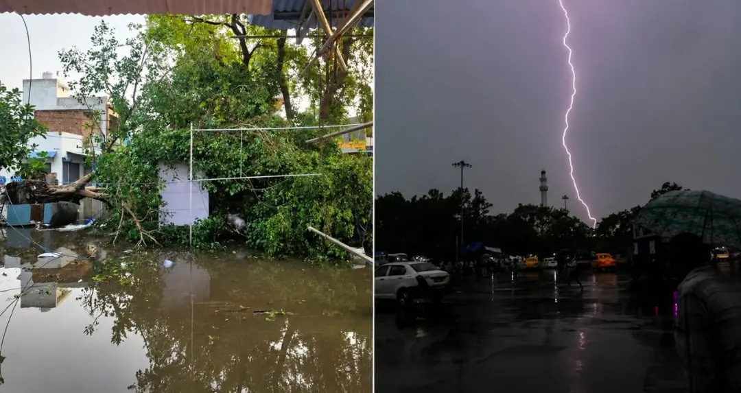
The southwest monsoon continues to advance across India, with weather conditions changing rapidly. According to the India Meteorological Department (IMD), the monsoon has entered several parts of Jharkhand and Odisha. After making its onset over Kerala, the monsoon has reached 19 states within nine days, indicating a rapid pace of its seasonal advance.
However, the monsoon's progress remains comparatively slow over parts of Maharashtra. Meteorologists estimate that it will advance further over the next few days and cover most areas of Chhattisgarh and Uttar Pradesh.
According to the IMD, the monsoon is likely to enter Chhattisgarh and Uttar Pradesh during the next three days. Pre-monsoon activity is also expected to become more active across large parts of central and northern India.
The weather department said pre-monsoon activity is continuing across most states except Gujarat. Thunderstorms, b winds and rainfall are being reported in several regions, bringing relief from intense heat.
The IMD has issued an orange alert for 22 states, including Madhya Pradesh, Rajasthan, Chhattisgarh, Jharkhand, Punjab, Himachal Pradesh, Uttarakhand and Jammu and Kashmir. These states are likely to experience thunderstorms, rainfall and wind speeds of up to 60 kmph at some places.
Experts said people should avoid open areas, weak structures and standing under trees during this period. Farmers and local administrations have also been advised to follow weather warnings.

Sudden changes in weather have resulted in fatalities in Madhya Pradesh and Bihar.
In Madhya Pradesh's Sheopur district, four people died in separate incidents during b winds and rain. Three of the deceased were reported to be members of the same family.
In Bihar, at least 10 people died in lightning incidents. Thunderstorms and lightning were reported across several parts of the state. The administration appealed to people to remain in safe locations during adverse weather conditions.
Delhi-NCR, Haryana and adjoining areas recorded a fall in temperature following b winds and rainfall. Wind speeds of 70 to 80 kmph were recorded in several areas during the night, providing relief from intense heat.
However, b winds uprooted trees, damaged electricity poles and disrupted power supply in some areas.
According to the IMD, dust storms are likely in several parts of Rajasthan. Meanwhile, humid weather is expected over the Konkan and Goa region adjoining Maharashtra.
Strong onshore winds may affect the coastal areas of Karnataka and Kerala, while heatwave conditions may continue over Telangana, Vidarbha and the coastal districts of Andhra Pradesh. Maximum temperatures in these regions are expected to remain between 40 and 45 degrees Celsius.

The U.S. weather agency, the National Oceanic and Atmospheric Administration (NOAA), has confirmed the development of El Niño conditions over the Pacific Ocean. According to scientists, El Niño has become active due to rising sea surface temperatures and is likely to strengthen further by the end of the year.
Experts believe the event could be as b as, or ber than, the historic 1997-98 El Niño. According to the agency, there is a 63 percent probability that it will rank among the best El Niño events recorded since 1950.
El Niño may affect rainfall, temperatures and agricultural production in several countries. Meteorologists in India are continuing to monitor its potential impact.
Although rainfall has begun in many parts of the country, high temperatures continue in several states. Maximum temperatures remained above 40 degrees Celsius in many cities across Uttar Pradesh, Delhi, Rajasthan, Madhya Pradesh, Maharashtra, Gujarat, Punjab, Chhattisgarh, Odisha, Telangana and Haryana.
Bathinda in Punjab recorded the country's highest temperature at 46.2 degrees Celsius. Higher-than-normal temperatures were also reported in Sri Ganganagar in Rajasthan, Wardha in Maharashtra, Jhansi in Uttar Pradesh and Khajuraho in Madhya Pradesh.
Weather experts said heat and humidity may continue in several regions until the monsoon becomes fully active.
According to the IMD forecast, b winds and rainfall are likely across several northern states over the next two days. Delhi, Punjab, Haryana, Rajasthan and Uttar Pradesh may receive thunderstorms and rainfall, with wind speeds expected between 50 and 70 kmph.
Rain accompanied by hail is also likely over the hilly regions of Jammu and Kashmir, Himachal Pradesh and Uttarakhand. Bihar, Jharkhand and Odisha are expected to receive widespread rainfall accompanied by thunderstorms, with heavy rainfall possible at some places.
In southern India, monsoon activity is expected to remain active over Kerala, Karnataka, Tamil Nadu and Telangana. Heavy rainfall is forecast particularly in the coastal districts of Kerala and Karnataka.
As the monsoon continues to advance across the country, it is expected to influence agriculture, water resources and temperatures. At the same time, weather-related hazards including thunderstorms, lightning and heavy rainfall continue to pose challenges. The IMD has urged citizens to monitor regular weather updates and follow safety advisories issued by authorities.
Experts said that if the monsoon continues to advance at the current pace, widespread rainfall is likely across most parts of the country in the coming days, providing relief from intense heat and supporting the sowing of kharif crops