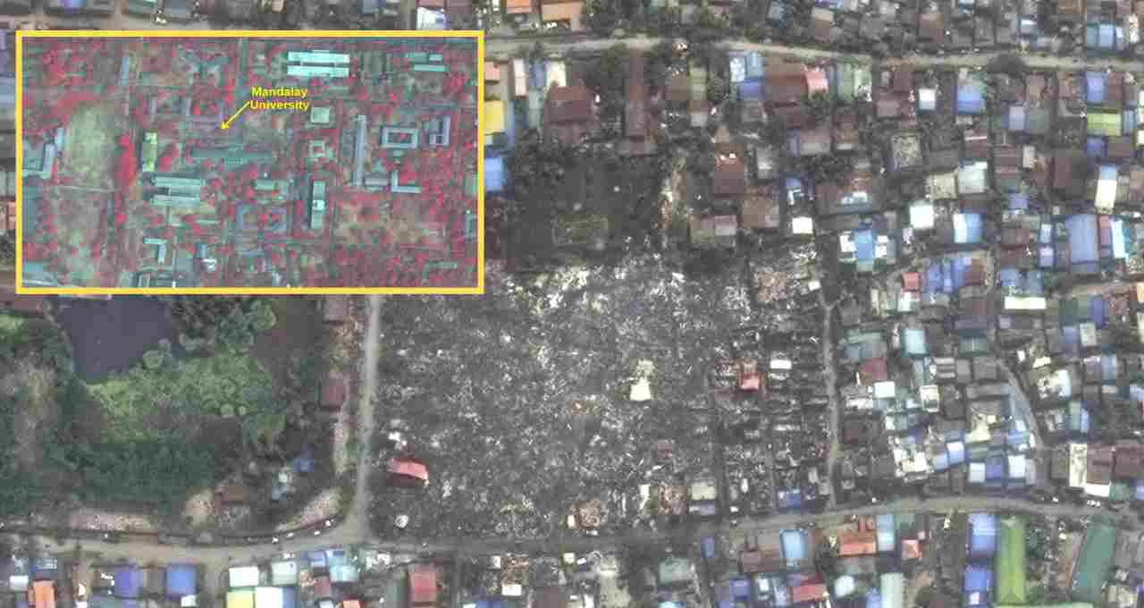
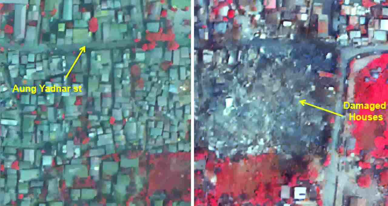
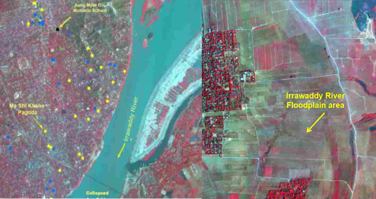
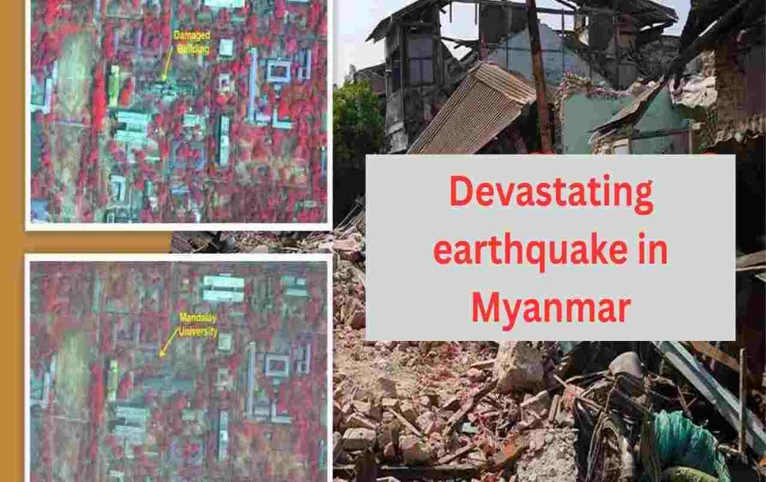
The Indian Space Research Organisation (ISRO) has released satellite images depicting the extensive damage caused by the 7.7 magnitude earthquake in Myanmar, vividly illustrating the devastating consequences of this natural disaster. These high-resolution images, captured by ISRO's Cartosat-3 satellite, show the destruction across major cities and historical sites in Myanmar.
ISRO: From the ground, we cannot fully grasp the impact of an earthquake. However, when these events are captured from the sky, their true scale and reality become apparent. The Indian Space Research Organisation (ISRO) recently released satellite images of the devastating 7.7 magnitude earthquake in Myanmar. These images not only showcase the widespread destruction but also illustrate how this natural disaster completely ravaged cities, historical sites, and the lives of the people.

Information derived from satellite imagery facilitates the analysis of the earthquake's impact and aids in relief and reconstruction efforts.
ISRO Satellite Imagery
These satellite images reveal the true extent of the devastation, which appears far more catastrophic than mere statistics suggest. ISRO has highlighted the heavy damage in cities like Mandalay and Sagaing, where prominent historical sites, including the Ananda Pagoda and Mahamuni Pagoda, were also affected. Notably, the Ananda Pagoda, a UNESCO World Heritage site, suffered significant structural damage.

Furthermore, the satellite images show signs of soil liquefaction in various parts of Myanmar. This process, where soil mixes with water to become mud during an earthquake, caused further damage to buildings.
Extent of Damage
According to ISRO scientists, Myanmar's region lies on the boundary of the Indian and Eurasian tectonic plates, making it prone to frequent earthquakes. These earthquakes are caused by the Indian plate's northward movement of approximately 5 centimeters annually, generating seismic stress. When this stress is suddenly released, major earthquakes, such as the one witnessed recently, occur.

The earthquake in Myanmar resulted in 2,056 fatalities and approximately 3,900 injuries. Relief efforts have faced numerous challenges, particularly due to the ongoing civil war in the country, which hinders aid delivery. ISRO's satellite imagery not only underscores the severity of the earthquake's impact but also highlights the importance of satellite technology in disaster management. This technology can prove to be a crucial tool for rapid analysis and effective relief operations in future disasters.


