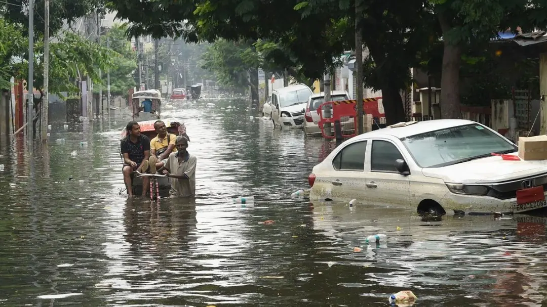
Concern over the Ganga water level in Bhagalpur has increased again after indications of a rise in the river level. People had received some relief after the water level declined in recent days, but central and state flood monitoring reports have now indicated the possibility of a further increase.
On Wednesday, September 2, the Ganga water level at the Bhagalpur station gauge was recorded at 33.27 metres, against the danger mark of 33.68 metres. The river was therefore about 41 centimetres below the danger mark at the station.
Earlier, the Ganga water level in Bhagalpur had been recorded at 33.24 metres and remained around that level from Tuesday morning. Before that, the level had reached 33.30 metres, registering a decline of about six centimetres. The fall in the water level had provided some relief to the administration and people living along the river, but the possibility of another rise has increased concern.

According to a report from the Flood Control and Irrigation Department, the Ganga water level may rise slightly in the coming period, after which it is expected to stabilise. Although the river is currently below the danger mark at the Bhagalpur station, continued rainfall and water arriving from upstream catchment areas could change the situation. The concerned departments are therefore maintaining continuous monitoring of the water level.
Water levels are also being monitored in other riverbank areas of Bhagalpur district. According to government flood forecast data, the Ganga was recorded at 31.08 metres at Ajmabad, against a danger level of 30.54 metres, meaning the river was already flowing above the danger mark there. At Sultanganj, the Ganga was recorded at 35.85 metres against a danger level of 34.50 metres. In Kahalgaon, the water level was recorded at 31.69 metres, above the danger mark of 31.09 metres.
The Ganga's situation is therefore not uniform across different parts of Bhagalpur district. At the main Bhagalpur station gauge, the river remains below the danger mark, while water levels at Ajmabad, Sultanganj and Kahalgaon have crossed the respective danger levels. This could increase difficulties for villages along the river, diara areas and other low-lying locations.
A rise in the Ganga water level first affects low-lying areas around the river. Increasing water levels can lead to water entering agricultural fields, waterlogging on rural roads and disruption of movement in diara areas. In several locations, people depend on boats or other means for farming and daily needs. Rising water levels can require increased vigilance by the administration in these areas.
The Bhagalpur administration is already maintaining vigilance over the Ganga water level. Embankments and sensitive locations are being monitored. In recent days, fluctuations in the Ganga and Kosi water levels in several parts of the district have also led Water Resources Department officials to inspect sensitive embankments. The security of embankments and flood-fighting works in areas including Raghopur are being monitored.
The risk of erosion also increases with a rise in the Ganga water level. Riverbank areas of Bhagalpur have already been facing erosion. An increase in water levels can raise the pressure of the river current on embankments and villages located along the river. The administration therefore faces the simultaneous challenges of flood protection and preventing riverbank erosion.
The recent decline in the water level had provided relief to residents. In Bhagalpur, the Ganga had fallen from 33.30 metres to 33.24 metres and remained stable at around that level for some time. The concerned department had also not indicated any immediate major threat. However, the possibility of a further rise has made the next few days significant.
A rise in water levels could also affect roads used for movement in rural areas. Roads that are already at lower elevations may become difficult to use after waterlogging. Boat operations and relief arrangements may also have to be activated as required. The administration seeks to identify sensitive areas before water levels reach critical levels.
Official flood forecast data for Bihar also records several locations where rivers are flowing above their danger marks. Apart from the Ganga, several other major rivers in the state are also above warning or danger levels at various locations. The potential rise in the Ganga level in Bhagalpur is therefore being viewed alongside the broader flood situation in the state.
The situation in Bhagalpur has not become completely uncontrolled. The Ganga remains below the danger mark at the main city gauge, and the department continues to monitor the river. However, water levels at some other monitoring stations have already crossed their danger marks, while another rise is now forecast.
If the pace of the water-level increase remains limited in the coming days, the situation may remain controlled. However, continued rainfall or increased water pressure from upstream could cause the river level to rise rapidly, increasing the flood risk in low-lying areas. The administration and Water Resources Department are continuing to monitor every change in the Ganga water level.