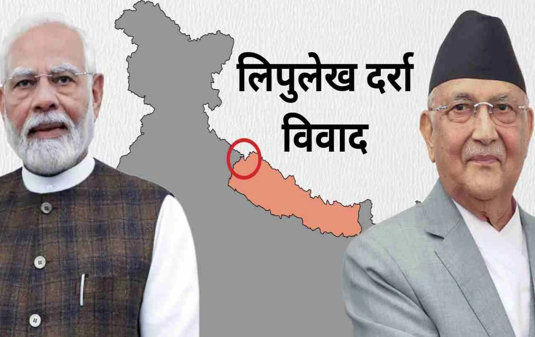

The Lipulekh Pass, which has long served as a trade route between India and China, is currently in the spotlight. Recently, Nepal objected to India-China trade through this pass, which was outright rejected by the Indian Ministry of External Affairs (MEA).
New Delhi: The Indian Ministry of External Affairs on Wednesday dismissed Nepal's concerns regarding India-China trade through the Lipulekh Pass. The Lipulekh Pass has historically been used as a trade route between India and China.
However, trade between the two countries through this region was disrupted after the border conflict in 2020 and then the COVID-19 pandemic. Now that India and China have agreed to resume trade through this route, Nepal has raised the issue.
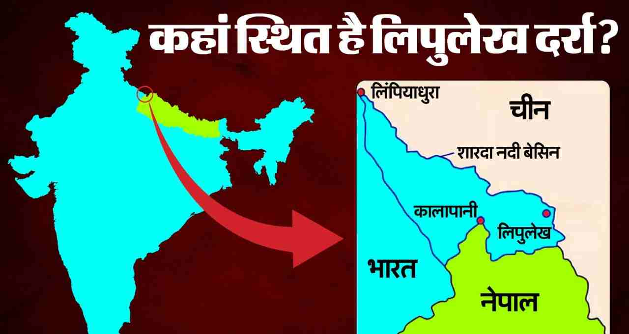
What is the Lipulekh Pass and where is it located?


The Lipulekh Pass is located in the Pithoragarh district of Uttarakhand and borders Nepal. Situated at an altitude of approximately 17,000 feet above sea level, it lies in the Himalayas. This pass is not only important as a trade route but also has religious significance. Followers of Hinduism, Buddhism, and Jainism consider it a traditional route to Kailash Mansarovar.
Additionally, the pass is crucial for India from a diplomatic and military perspective. This route is strategically important for road connectivity and military logistics on the India-China border.
Nepal's objection: What was said?
Nepal has claimed that the Kalapani, Limpiyadhura, and Lipulekh regions are located east of the Mahakali River and have historically been a part of Nepal. They state that these areas are included in their official map and constitution. Nepal has appealed to India and China to refrain from conducting trade through this pass. However, India has rejected this, stating that Nepal's claims are not based on justifiable or historical evidence. Indian Ministry of External Affairs spokesperson Randhir Jaiswal said that this trade has been ongoing since 1954 and has only been disrupted in recent years due to COVID-19 and other reasons.
History of the Lipulekh Pass
The war between the British and Nepal took place in 1814-16. Following this, under Article 5 of the Sugauli Treaty in 1816, Nepal had to cede control of the territories located northwest of the Kali River (Mahakali River) to the East India Company. During British rule, maps of India showed the Kali River as the India-Nepal border.
Before the 1962 India-China war, the Nepalese government conducted censuses in Kalapani, Gunji, Nabhi, and Kuti, and also collected revenue here. After the war, India, under the leadership of Prime Minister Jawaharlal Nehru, obtained permission from Nepal to use these areas. Subsequently, the Indian Army established bases and road connectivity in the region.
This region of Nepal is also a route to Kailash Mansarovar from a religious point of view. This pass is important for connecting the Kumaon region of Uttarakhand in India and Taklakot in Tibet.
India-China trade and Nepal's objection
India maintains that India-China trade through the Lipulekh Pass has been ongoing continuously since 1954. Trade was disrupted for some time in 2020 due to road construction and COVID-19. Nepal protested when India and China recently agreed to resume trade. Nepal has raised this issue from time to time in the past as well. In 2016, Nepal registered its protest in Parliament and at the street level against the initiative to increase trade by Prime Minister Narendra Modi.
In 2020, India built an 80-kilometer-long road up to the Lipulekh Pass, which was inaugurated by Defense Minister Rajnath Singh. Nepal termed this as a violation of the bilateral agreement to resolve the border dispute. India has clearly stated that the Lipulekh Pass is geographically and historically a part of India. The Ministry of External Affairs has also said that Nepal's territorial claims are merely unilateral and artificial. India is always ready to resolve all border disputes with Nepal through diplomatic talks.