
The Israeli Defense Forces (IDF) incorrectly depicted India's map in a graphic, prompting an apology and clarification on social media following criticism from Indian users.
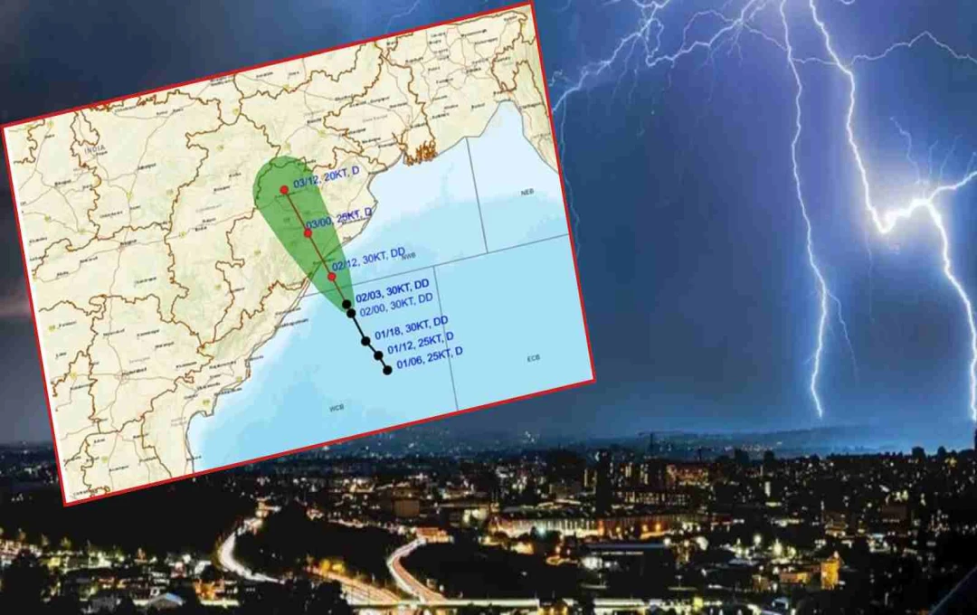
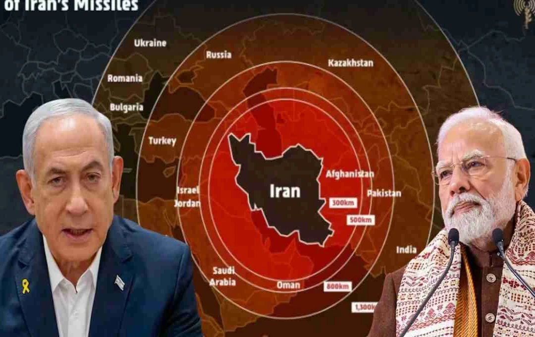
Israel: The Israeli Defense Forces (IDF) recently shared a graphic on social media illustrating Iran's missile range. This graphic incorrectly portrayed India's map. Specifically, Jammu and Kashmir was shown as part of Pakistan, and the northeastern states were depicted as part of Nepal. Upon publication, Indian users objected to this error, sparking a debate on social media.
Israel Admits Error, Publicly Apologizes
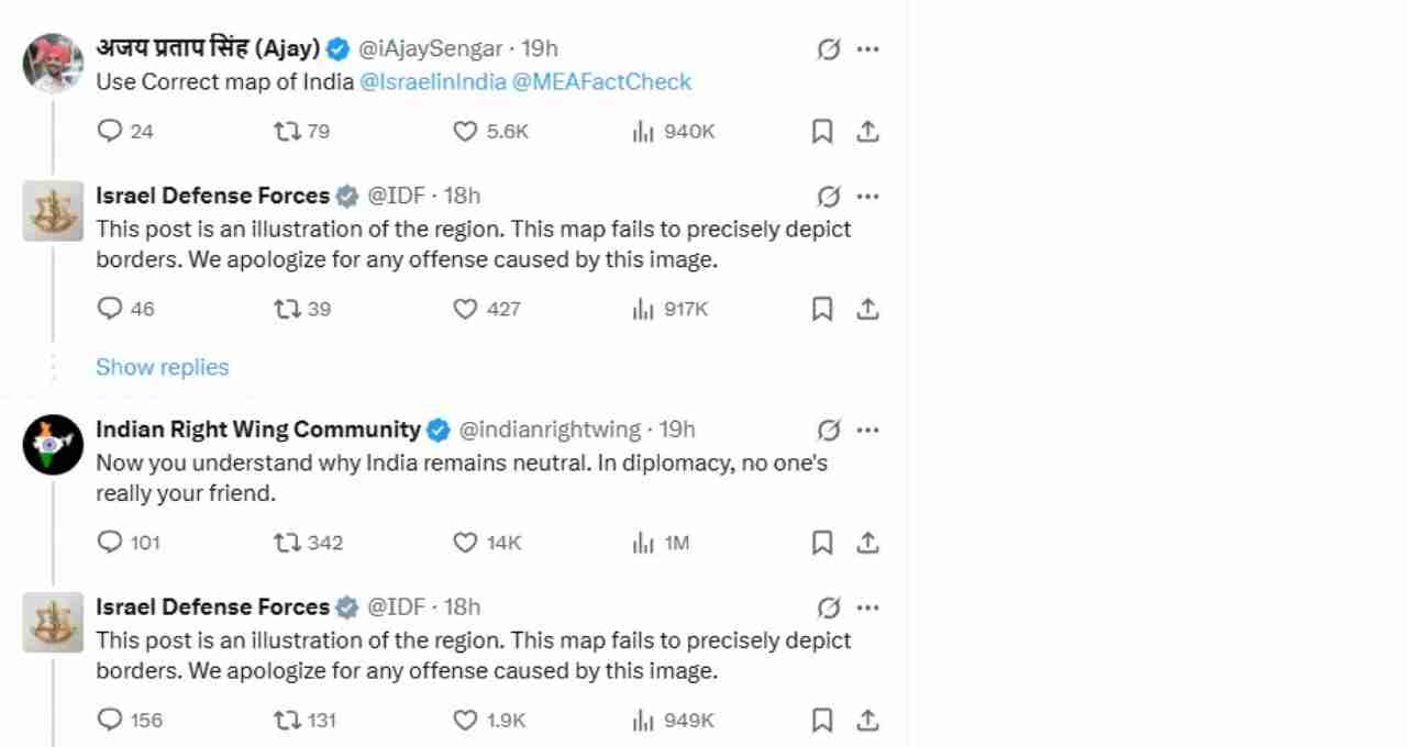
Following the controversy, the IDF responded promptly and formally apologized for the mistake on Saturday. The IDF clarified that the graphic's purpose was not to accurately depict any country's political boundaries, but rather to illustrate Iran's missile range. They expressed regret if anyone's feelings were hurt.


Graphic Shows Several Countries, Including India, Within Missile Range
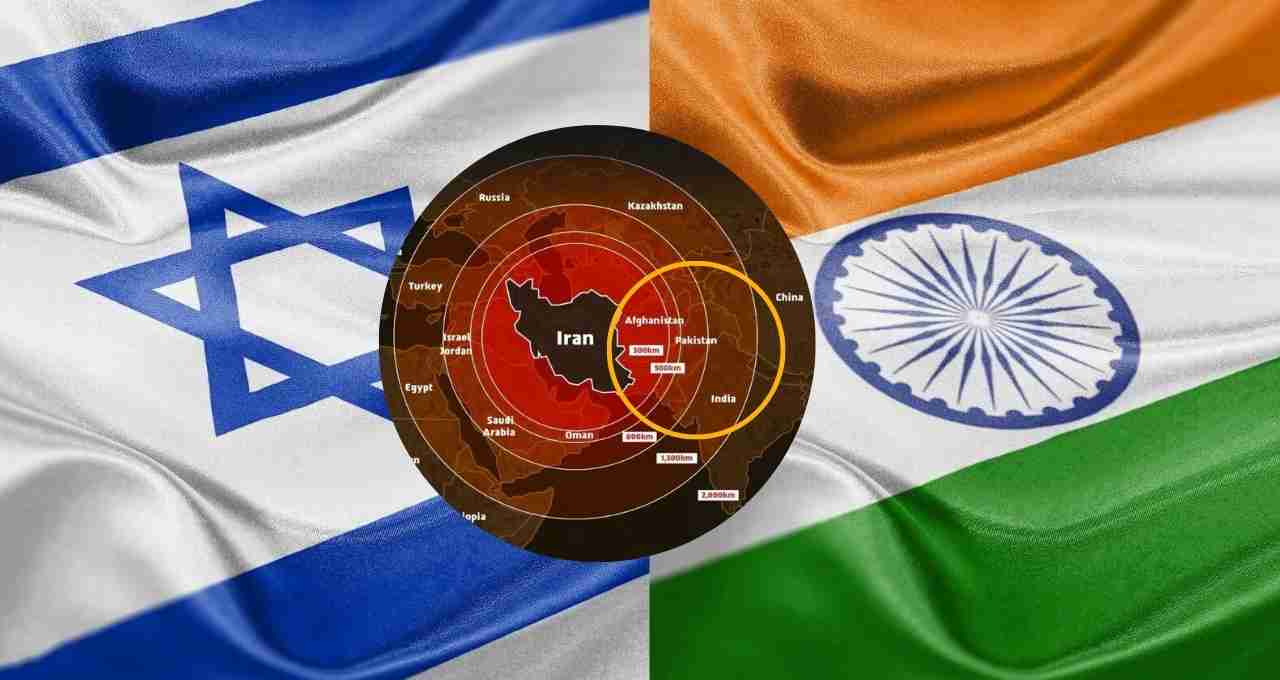
Besides India, the IDF's graphic depicted approximately 15 other countries, including Russia, Ukraine, China, and Sudan, within Iran's missile range. The post stated that "Iran is a threat not only to Israel but also globally." This message accompanied the map, which included India within the range.
Apology Follows Indian Users' Reaction
Reacting to the IDF's post, numerous Indian social media users highlighted the errors in the map. Users questioned why India's map was incorrectly depicted despite being an allied nation. In response, the IDF apologized, stating that the map was symbolic and not intended to be a politically accurate depiction of borders.
Sensitivity Regarding India's Territorial Integrity
Territorial integrity is a sensitive issue in India. Both the central government and Indian citizens are extremely vigilant about the depiction of India's map. Any public error of this nature immediately elicits b objections. Several international companies and organizations have previously had to apologize for similar mistakes.
Incident Occurs Amidst Iran-Israel Conflict
This controversy unfolded amidst heightened military tension between Iran and Israel. Israel recently conducted large-scale air strikes on Tehran, prompting a retaliatory missile attack from Iran. The IDF's graphic was shared during this military standoff, generating considerable international discussion.
Incorrect Map Presentation Raises Diplomatic Questions
This error not only sparked a social media controversy but also created unease at the diplomatic level between India and Israel. While Israel's apology helped de-escalate the situation, it highlights the need for public institutions to exercise extreme caution when dealing with sensitive geographical issues.
Responsibility of Public Institutions
This incident reiterates that regardless of how friendly a nation may be, incorrectly depicting another country's borders can become a serious issue. This responsibility is amplified when the information originates from a governmental or military institution.