
ISRO and NASA's Joint Mission 'NISAR' to Launch Today. This satellite will monitor changes on Earth, climate, landslides, and disasters.
Satellite NISAR: 'NISAR' satellite, a result of technical collaboration between the Indian and American space agencies ISRO (Indian Space Research Organisation) and NASA (National Aeronautics and Space Administration), is scheduled to launch from Sriharikota today. This mission will closely monitor the Earth's condition, climate change, natural disasters, and glacial changes. This is not only a new chapter in India-US cooperation, but also a major step in space science.
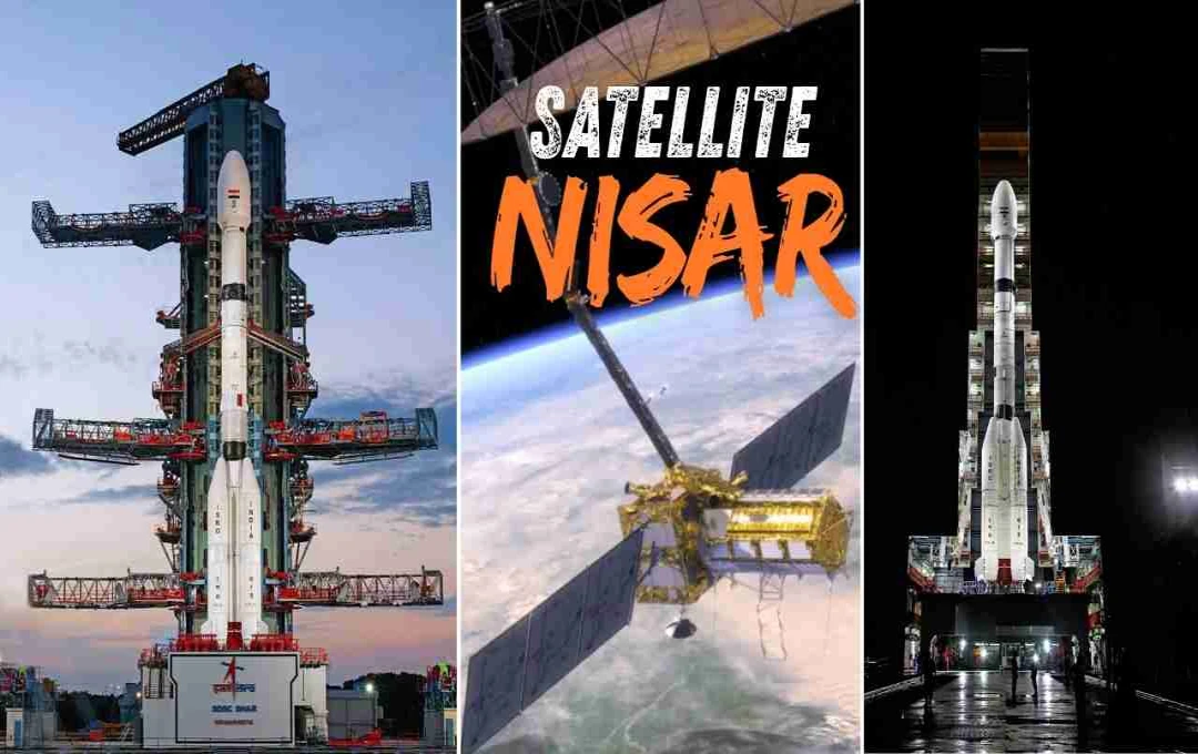
Launch from Sriharikota
The NASA-ISRO Synthetic Aperture Radar (NISAR) will be launched from the Satish Dhawan Space Centre in Sriharikota, India, on Wednesday at 5:40 PM via the GSLV-S16 rocket. The countdown for this launch began on July 29th. The total length of the rocket is 51.7 meters and the satellite weighs approximately 2,393 kilograms. This satellite will be sent into a Sun-Synchronous Polar Orbit.


What is the NISAR Satellite?
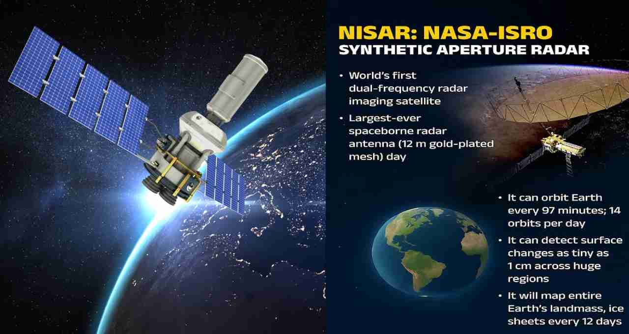
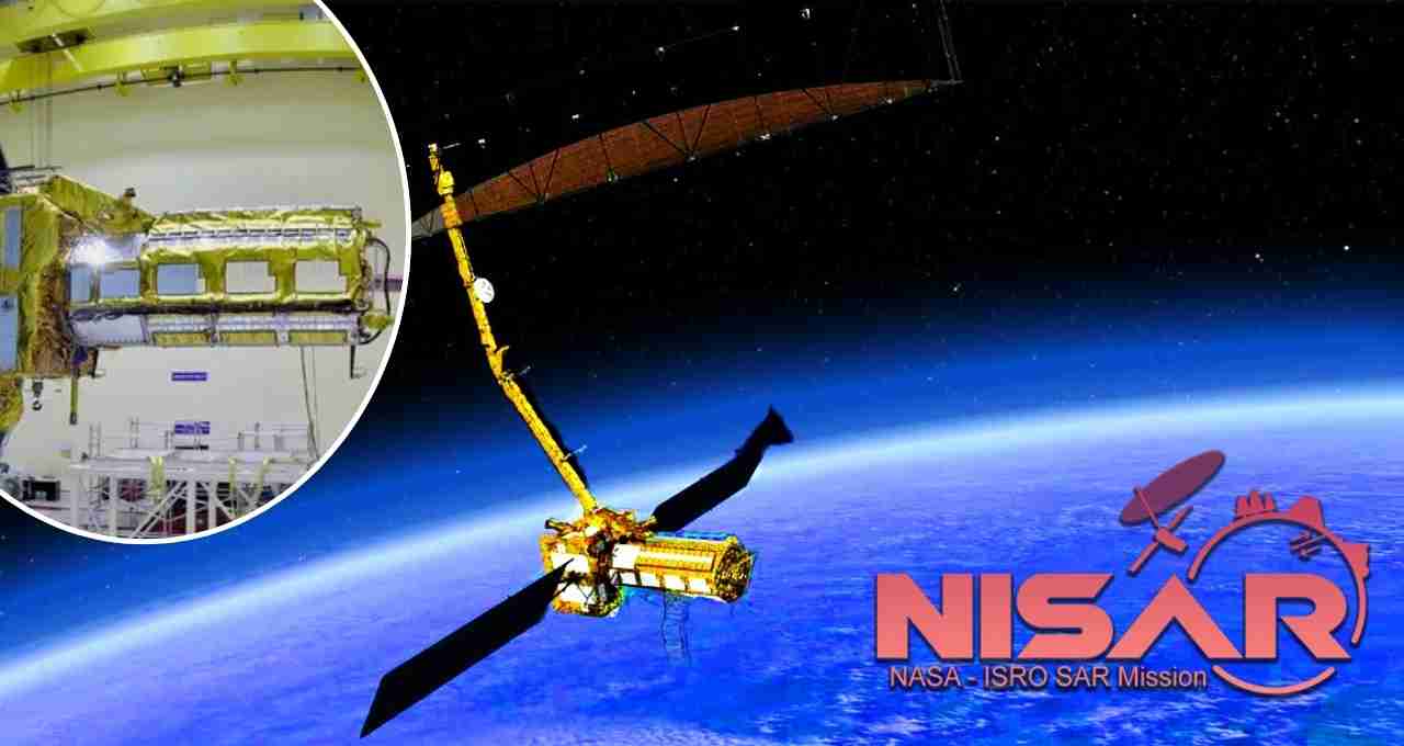
NISAR, or NASA-ISRO Synthetic Aperture Radar, is an advanced Earth-observing satellite equipped with a dual-frequency radar system. It includes both L-band and S-band, enabling it to take pictures of the Earth's surface day and night, in any weather. It is the first satellite in the world to use this type of dual system.
Which Areas Will Be Covered?
The purpose of this satellite is to record the Earth's changing forms, such as melting icebergs, landslides, expansion or erosion of forests, and movements related to earthquakes. NISAR will also accurately monitor sensitive areas such as the Himalayas, Antarctica, and forests. Its information will play an important role in disaster management, meteorology, and environmental studies.
First Launch into Sun-Synchronous Orbit via GSLV
Typically, satellites are sent into sun-synchronous orbit via the PSLV rocket. However, for the first time, the GSLV Mk II is being used for this type of mission. The GSLV has the capacity to carry heavier satellites, and it is the ideal choice for a heavy and complex satellite like NISAR.
Symbol of India-US Partnership in Space
The NISAR mission is a symbol of the growing space cooperation between India and the United States. ISRO and NASA have realized this project through technical and scientific collaboration for more than a decade. NISAR has been built in both India and the United States, and significant parts have been contributed by both countries.
Helpful in Disaster Management
The NISAR satellite can bring about revolutionary changes in disaster management. It will be able to analyze disasters such as earthquakes, floods, landslides, and droughts in real-time. With its help, timely warnings can be issued to reduce the loss of life and property.
Monitoring the Environment and Climate Change
Climate change is a global concern today. NISAR's data will help scientists develop a deeper understanding of the changes related to the Earth's climate. This mission will continuously monitor subjects such as deforestation, melting of ice sheets, and the behavior of oceans.
Features of NISAR
- Equipped with dual frequency radar (L-band and S-band)
- Monitoring the Earth day and night and in all weather
- Mapping the Earth on a global scale every 12 days
- Ability to identify surface activities down to 1 centimeter